About 20 miles of dirt, gravel and sand lay ahead. We're headed for the Picacho California State Recreation area. It's on the California side of the Colorado River. That's Quartz Peak in the distance.

Barren land, but we're getting closer. Quartz Peak looks different from here.

Redd on his T-Dub. Looks like Badlands..it is.

Canyons carved by Flash floods and other natural occurrences. It's pretty down here.

A dark cloud. No rain in the forecast, but it's only 80 degrees today. Coolest day in the two weeks we've been down here.

These little TW200's are perfect for this kind of riding. Very low geared, but will easily go 60 mph if needed. We cruised mostly between 30 and 40. Lots of sliding around.

We're getting closer. Quartz Peak.

Closest we got to the Peak.

There are Burro trails in and out of this canyon. Not unusual to see wild ones in this area.

Redd was going a little too fast down this grade, and couldn't get out of the loose sand of the berm. So, down he went! Hurt his knee and foot a little, but he'll live. Bike only got a few scratches, and self adjusted some things we were able to fix.

The headlight cover was full of rocks, this is after we got most of them out. :-)

Looking up a high bluff.

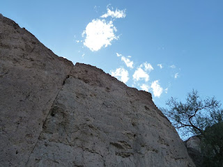
Big rock and Sky. Pictures don't do it justice.

We thought this would be a nice place to camp out sometime. Sheltered from the wind.

Redd by the All American Canal. This starts North of Yuma at the Imperial Dam on the Colorado. It goes down to Mexico, then turns West and Irrigates the Imperial Valley.

A 2010 and a 2008. Both bikes worked perfect. They get close to 80 mpg!
 About 20 miles of dirt, gravel and sand lay ahead. We're headed for the Picacho California State Recreation area. It's on the California side of the Colorado River. That's Quartz Peak in the distance.
 Barren land, but we're getting closer. Quartz Peak looks different from here.
 Redd on his T-Dub. Looks like Badlands..it is.
 Canyons carved by Flash floods and other natural occurrences. It's pretty down here.
 A dark cloud. No rain in the forecast, but it's only 80 degrees today. Coolest day in the two weeks we've been down here.
 These little TW200's are perfect for this kind of riding. Very low geared, but will easily go 60 mph if needed. We cruised mostly between 30 and 40. Lots of sliding around.
 We're getting closer. Quartz Peak.
 Closest we got to the Peak.
 There are Burro trails in and out of this canyon. Not unusual to see wild ones in this area.
 Redd was going a little too fast down this grade, and couldn't get out of the loose sand of the berm. So, down he went! Hurt his knee and foot a little, but he'll live. Bike only got a few scratches, and self adjusted some things we were able to fix.
 The headlight cover was full of rocks, this is after we got most of them out. :-)
 Looking up a high bluff.
 Big rock and Sky. Pictures don't do it justice.
 We thought this would be a nice place to camp out sometime. Sheltered from the wind.
 Redd by the All American Canal. This starts North of Yuma at the Imperial Dam on the Colorado. It goes down to Mexico, then turns West and Irrigates the Imperial Valley.
 A 2010 and a 2008. Both bikes worked perfect. They get close to 80 mpg!
No comments:
Post a Comment